Category:Maps of global mean temperature
Jump to navigation
Jump to search
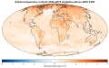
Yearly mean and long interval mean temperature, globally. Primarily air temperatur compilations or satellite measured surface temperature of land and sea. Including animations.
- Try to sort by mid of intervall
[[Category:Maps of global mean temperature|2004]]for 2000-2009,[[Category:Maps of global mean temperature|1979]]for 1960-1999 - Feel free to do subcategories of sets (as extractions of animatition, to keep them together - sort the main image also in here)
Subcategories
This category has only the following subcategory.
Media in category "Maps of global mean temperature"
The following 45 files are in this category, out of 45 total.
-
 CLIMAP.jpg 650 × 472; 124 KB
-
 Mid-Holocene Warm Period - globe.gif 600 × 800; 147 KB
-
 Woodbridge isothermal chart.jpg 3,360 × 2,636; 4.57 MB
-
 Woodbridge isothermal chart2.jpg 3,357 × 2,628; 6.24 MB
-
 Woodbridge isothermal chart3.jpg 3,338 × 2,413; 6.24 MB
-

-
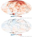
 Temperatures across the world in the 1880s and the 1980s - Brazil.jpg 798 × 385; 125 KB
-
 Temperatures across the world in the 1880s and the 1980s.jpg 616 × 677; 274 KB
-
 Earth Temperature.gif 640 × 480; 5.16 MB
-
 NCDC temperature trend.png 2,005 × 991; 2.18 MB
-
 Mapa globalnej temperatury2.jpg 800 × 596; 206 KB
-
 Mapa temperatury globalnej.svg 1,079 × 675; 687 KB
-
 Global Cooling Map.png 758 × 492; 141 KB
-
 NASA-global-warming-map-1970-79-to-2000-09.jpg 753 × 879; 288 KB
-
 MonthlyMeanT.gif 550 × 340; 405 KB
-
Summer temperatures Northern Hemisphere 1955 to 2011.ogv 31 s, 960 × 540; 2.45 MB
-
 NASA temperature trend.png 1,499 × 715; 936 KB
-
 Mapa globalnej temperatury.JPG 571 × 406; 47 KB
-
 Climate-change-template.jpg 80 × 40; 1 KB
-
 GISS temperature 2000-09 lrg.png 2,880 × 1,440; 545 KB
-
 Global Warming Map-he.jpg 800 × 596; 80 KB
-
 Global Warming Map.jpg 800 × 596; 212 KB
-
 2005 surface temperature anomaly.jpg 463 × 316; 205 KB
-
 Global Surface Temperatures in 2005.svg 675 × 394; 351 KB
-
 TempAnomaly 2005 cmp 1951-80.gif 540 × 312; 32 KB
-
 NOAA Temperature anomalies June 2010.gif 3,300 × 2,532; 283 KB
-
 Arctic Oscillation temperature anomalies.png 4,680 × 2,340; 5.67 MB
-
 2016 Climate Trends Continue to Break Records (28381930286).jpg 1,920 × 1,080; 126 KB
-
 Prognoza świat.JPG 559 × 408; 45 KB
-
 Annual Average Temperature Map.jpg 1,100 × 849; 385 KB
-
 Average yearly temperature per country.png 2,753 × 1,400; 95 KB
-
 CLIMAP - non-language.PNG 703 × 428; 222 KB
-
 Ecuadores.png 2,753 × 1,335; 233 KB
-
 Global Temperatures 1880-2011 (6731502729).jpg 1,280 × 720; 196 KB
-
 Global temperatures in 2017.png 720 × 445; 202 KB
-
 Global Warming Representation, NASA Goddard Photo & Video.jpg 1,920 × 1,080; 337 KB
-
 Hadcrut3 temperature anomaly 2000-2009.png 1,000 × 800; 140 KB
-
 Kuukauden keskilämpötila ympäri maailman.gif 550 × 340; 402 KB
-
 MODIS temperature map.jpg 720 × 398; 53 KB
-
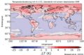 Nowack-atmos-chem-phys-16-4191-2016-fig2b-de.png 917 × 596; 213 KB
-
 Nowack-atmos-chem-phys-16-4191-2016-fig2b-en.png 917 × 596; 212 KB
-
 Opwarming van de Aarde map.png 774 × 522; 86 KB
-
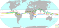
 WorldMap cold warm hot.svg 1,405 × 601; 288 KB
-
 Zonas térmicas de la Tierra.png 8,639 × 3,514; 1.14 MB
-
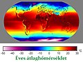 Átlaghőmérséklet a Földön.jpg 1,100 × 827; 208 KB


.jpg)


.jpg)


_and_the_1980s_(right),_as_compared_to_average_temperatures_from_1951_to_1980_(US_EPA).jpg)